

On September 4, the UN General Assembly endorsed a resolution encouraging maps that show the relative sizes of continents more accurately. The vote was overwhelmingly in favor: 164 countries supported it, one opposed it, and six abstained.
The Equal Earth projection, developed in 2018, preserves relative area. The familiar Mercator projection greatly enlarges land at high latitudes, so Greenland appears much closer to Africa in size than it actually is. Africa is roughly 14 times larger.
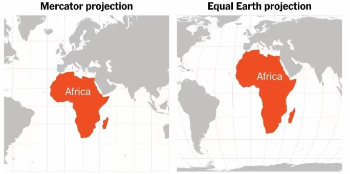
The resolution encourages a change in how world maps are presented; it does not legally prohibit Mercator maps. Mercator still has uses, particularly where preserving local angles matters. Every flat map makes tradeoffs, so the appropriate projection depends on what the map is meant to show.
Sources: the UN meeting release and UN Office of the Special Adviser on Africa.
Adapted from the original Chinese article, published on September 5, 2026.
Comments NOTHING